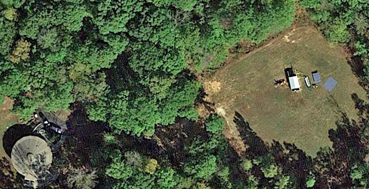
We live in a hardwood forest, but cleared nearly an acre to get a 30° horizon in most directions. This March 2017 satellite photo shows this clearing and the under-construction observatory with the roof partly open near the center. The blue rectangles are 25 lengths of freshly painted siding laid out to dry. Our round house can be seen 300 feet to the left.
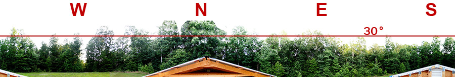
This 360° panorama was made with the camera directly over the telescope. North is a bit more obstructed than we had hoped for, but overall the horizon is satisfactory.
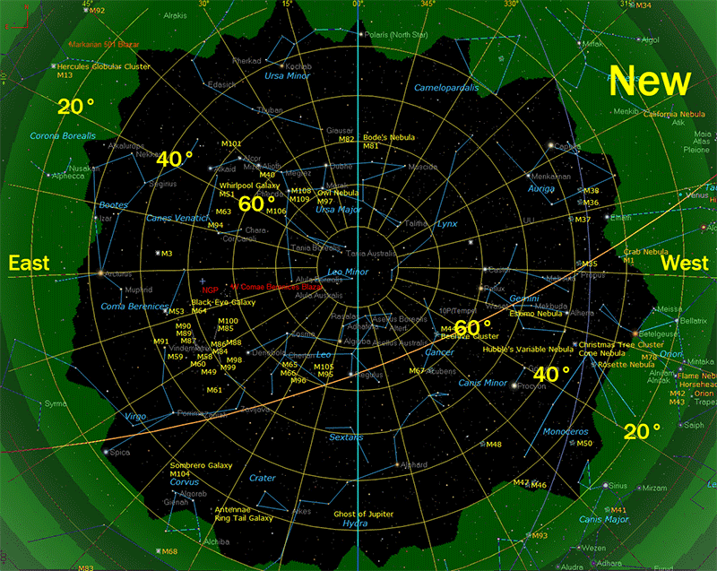
The new observatory's horizon is much lower and gives a much larger imaging area than at our former location.
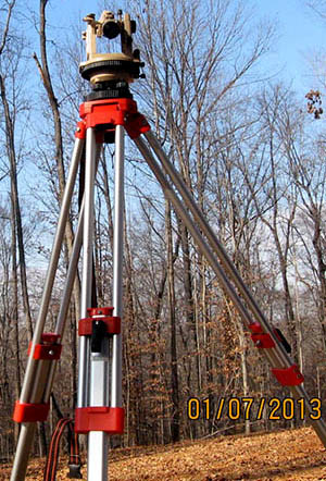
How did I measure the horizon elevations? I used a theodolite. This surveyor's instrument has a small telescope with crosshairs and degree scales for elevation and azimuth. I didn't need high precision, so I simply sighted along the top of the telescope toward the trees. Here's a photo of my theodolite on its tripod.
After finding the magnetic deviation at my location, I used a compass to determine true north, then set up the theodolite so it pointed there at 0° azimuth.
Next I measured the elevations of tree tops in 5° azimuth incements around the full circle, north-to-north. I recorded each azimuth and elevation on a simple form created in a spreadsheet program. Later I copied those numbers into the actual spreadsheet, then exported the data to a CSV file.
I imported my CSV data into TheSkyX planetarium software, and TheSkyX drew the horizon. Eight years ago I used the same process to create the "old" horizon at our former observatory.
I stopped the clock in TheSkyX so the sky wouldn't move between screen shots, then loaded one horizon at a time, and captured the screen image.
Finally, I loaded both horizon screen images into Photoshop CS6, and created the comparison animation seen above.
An alternative to a theodolite is a simple angle finder like this one. It has an elevation scale that's easy to make in vector graphics software like Adobe Illustrator or (free) Libre Office Draw. An attached level (lower-right) helps ensure the measured angles are accurate.
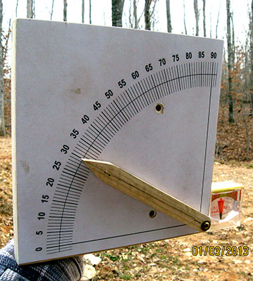
Aim the angle finder toward a tree, sight along the pointer at the treetop, and record that elevation. Determine the azimuth with a compass, and record that number as well.
Updated May 23, 2023